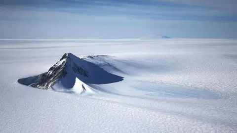
A new map has unmasked the landscape beneath Antarctica's ice in unprecedented detail, something scientists say could greatly enhance our understanding of the frozen white continent.
Researchers used satellite data and the physics of how Antarctica's glaciers move to work out what the continent might look like beneath the ice.
They found evidence of thousands of previously undiscovered hills and ridges, and say their maps of some of Antarctica's hidden mountain ranges are clearer than ever before.
While the maps are subject to uncertainties, the researchers believe the new details could shed light on how Antarctica will respond to climate change - and what that means for sea-level rise.
Dr. Helen Ockenden, a researcher at the University of Grenoble-Alpes, remarked that the new findings provide a much clearer view of Antarctica's bedrock than ever before, akin to a digital image replacing a grainy film.
For decades, traditional methods involved taking individual survey lines to map Antarctica's terrain, which left many gaps unaccounted for. This new mapping technique combines surface knowledge from satellites with physics-based glacial movement understanding, leading to the discovery of features like the Maud Subglacial Basin's deep channel.
The researchers' new map, while not definitive, gives scientists a valuable tool for predicting how Antarctica's ice and glaciers will behave in the face of climate change, ultimately informing global sea-level rise projections.