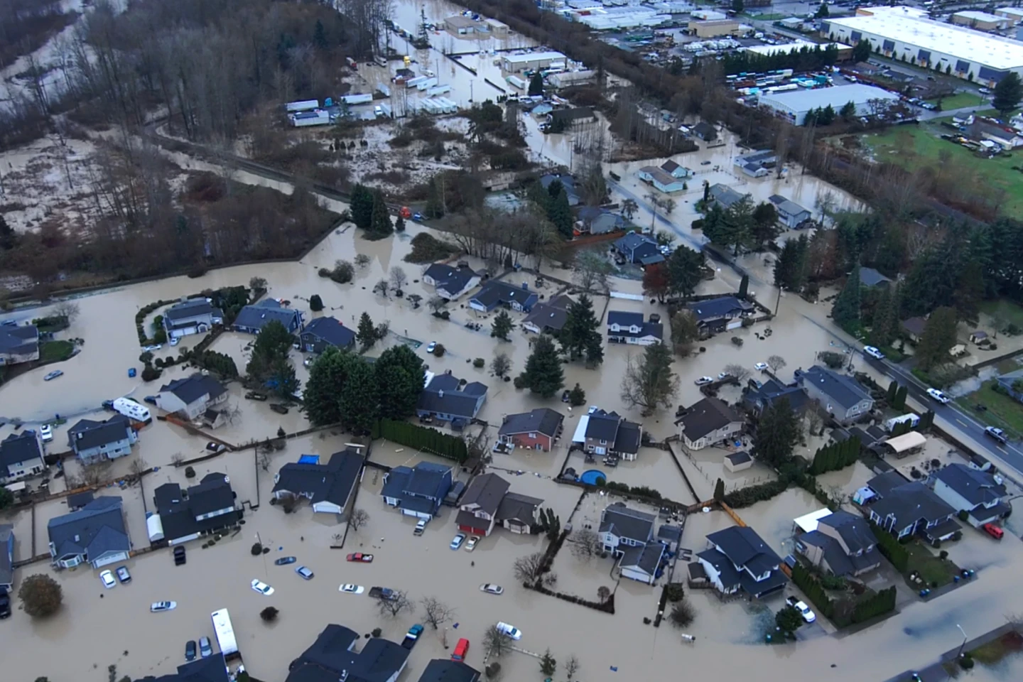
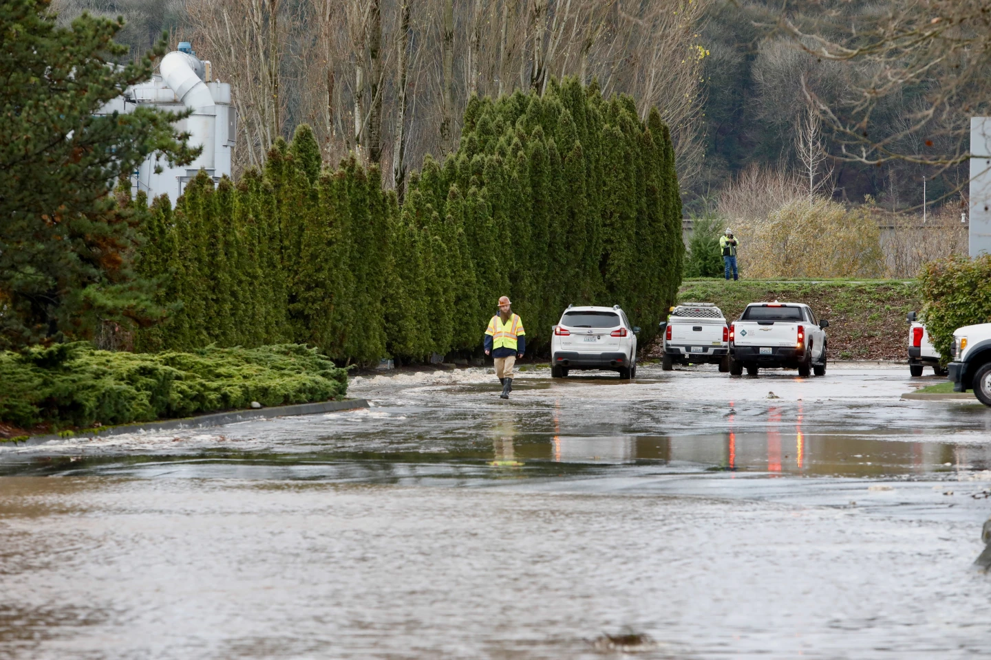
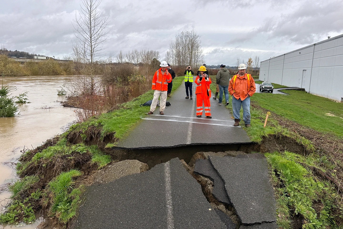
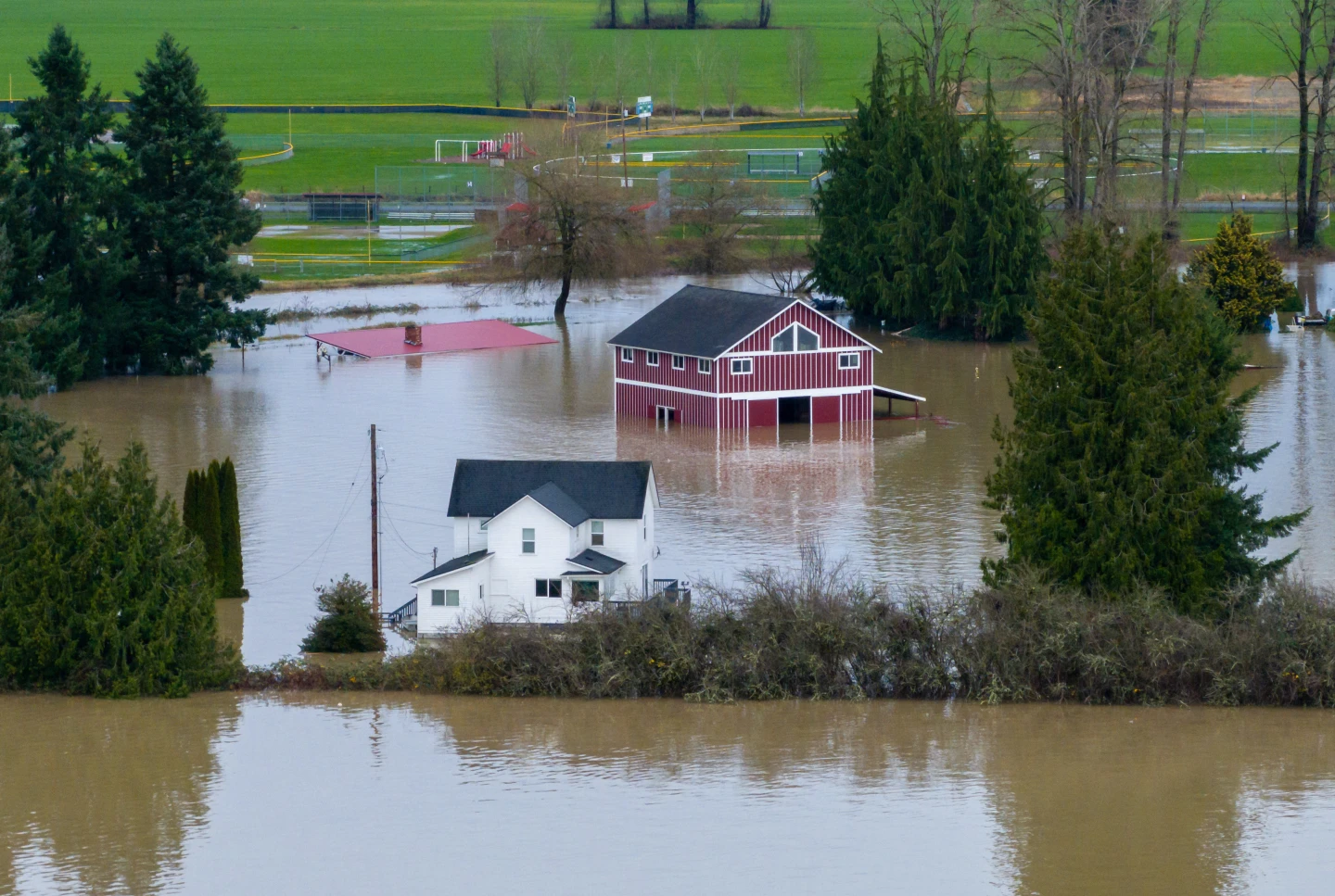
The Pacific Northwest is grappling with the effects of severe storms, which began affecting the region on Tuesday. The storms have led to heavy rains, swollen rivers, and emergency rescues as authorities respond to increasing flood risks.
According to the National Weather Service, heavy rainfall is anticipated across western Washington and northwestern Oregon for several days, exacerbated by a potent trans-Pacific jet stream. Currently, areas along the coast and in the Cascades are under flood watches with the possibility of flash flooding.
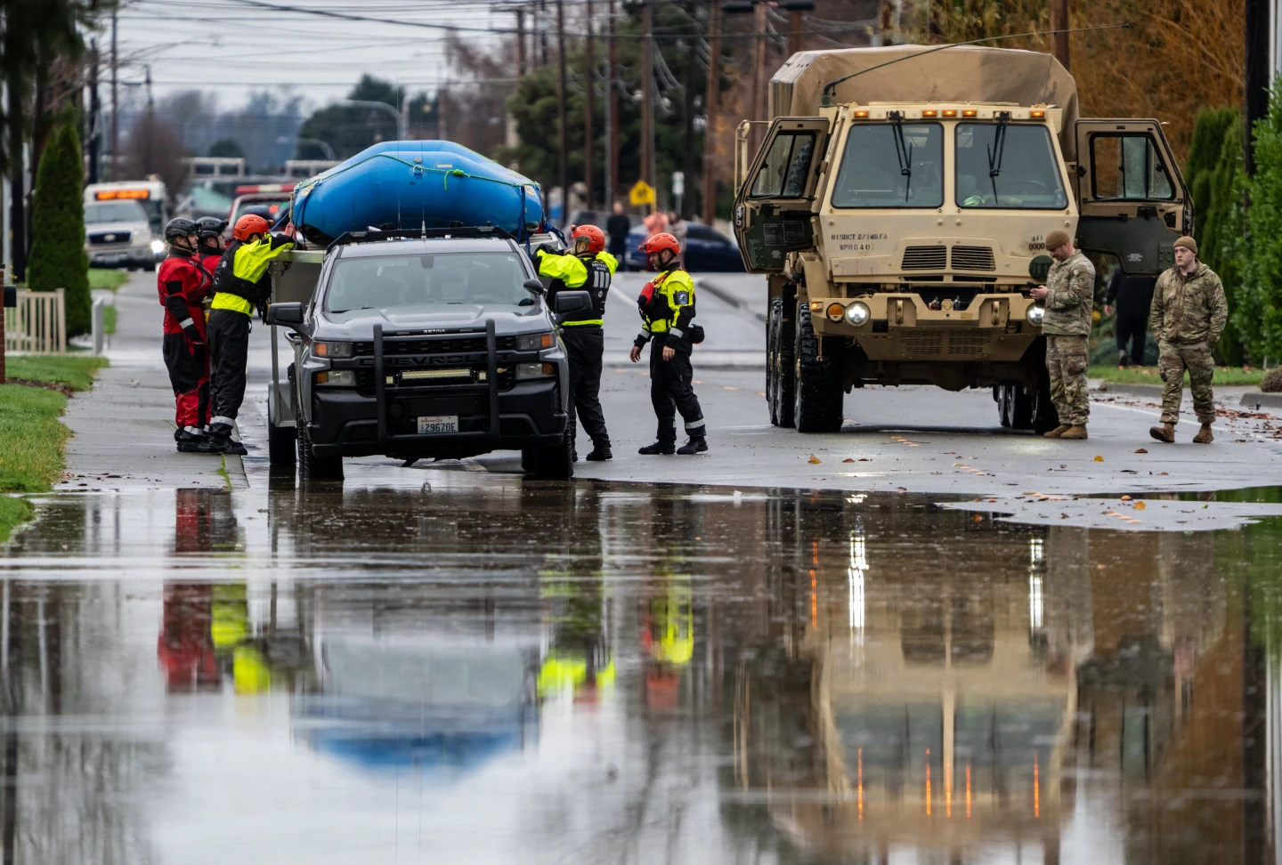
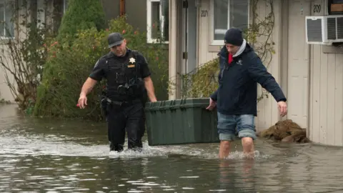
Emergency responders have been particularly active in Snohomish County, where fire crews conducted high water rescues at a campsite in Gold Bar, north of Seattle, on Monday night. Utilizing drones and specialized water rescue crafts, teams were able to rescue two individuals trapped by rising floodwaters.
Further developments revealed that the Skykomish River reached major flood status overnight, prompting warnings from the Snohomish County Department of Emergency Management for local residents, particularly those living in flood-prone areas. Authorities reported that door-to-door notifications were made in the Moonlight Drive area to warn residents of impending flooding.
As the storms continue to impact the region, transportation officials in Washington reported the temporary closure of Interstate 90 eastbound at North Bend due to debris. The roadway reopened early Tuesday morning as conditions began to stabilize.
The Seattle branch of the National Weather Service indicated that while the atmospheric river causing the storms had shifted to the south, more precipitation is expected to return later, potentially bringing further heavy rainfall and severe flooding.
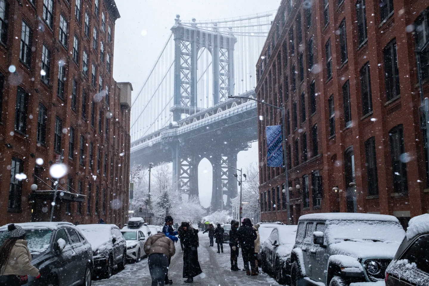
In addition to the Pacific Northwest, a storm system moving east has brought wintry weather to parts of the Upper Midwest, with officials warning of hazardous traveling conditions due to freezing rain and high winds. The impacts of this storm are projected to continue into the Great Lakes region by Wednesday.