MIAMI (AP) — A weather system that is forecast to become Tropical Storm Imelda later in the day before approaching the coast of South Carolina as a hurricane early next week was causing disruption in the Bahamas and nearby islands on Sunday.
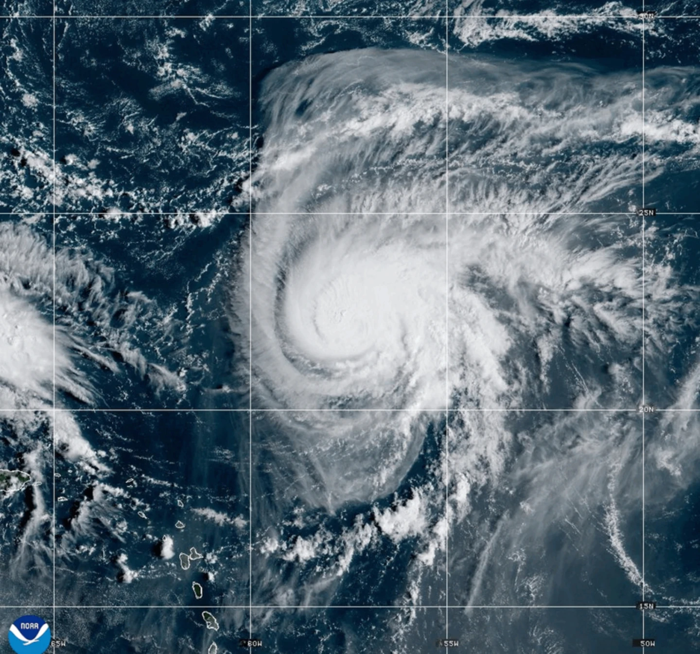
Meanwhile Hurricane Humberto weakened very slightly but remained a strong Category 4 storm in the Atlantic, threatening Bermuda.
South Carolina Gov. Henry McMaster urged people to monitor the weather closely and stay alert. And in North Carolina, Gov. Josh Stein declared a state of emergency in advance of the system, currently called Tropical Depression Nine.
Forecasters said the system was on track to become a tropical storm later Sunday and a hurricane by late Monday or Tuesday, to be named Imelda.
As of 0900 GMT Sunday, the system was located about 100 miles (160 kilometers) west-southwest of the Central Bahamas and was head north-northwest at 7 mph (11 kph). Its maximum sustained winds were 35 mph (55 kph).
“What we learn every time is we never know where they are going to go,” McMaster said during a news conference to discuss the storm. “This storm is deadly serious. Not just serious. Deadly serious.”
The storm could bring high winds and heavy rain, which could produce flooding, he said. The state was prepositioning search and rescue crews over the weekend.
Hurricane Humberto had maximum sustained winds of 155 mph (250 kph), according to the National Hurricane Center in Miami, making it a Category 4 hurricane. It was located about 585 miles (945 kilometers) south of Bermuda and was moving west-northwest at 13 mph (20 kph).
A tropical storm watch could be required in Bermuda later in the day, forecasters said, and swells could reach the U.S. east coast on Monday.
Tropical Depression Nine was threatening parts of Cuba and the Bahamas with heavy rainfall and flash flooding, with portions of the latter under a tropical storm warning. More warnings and watches were expected later Sunday, the hurricane center said.
The Bahamas’ Department of Meteorology urged people in the northwest and central islands, which include Nassau, Andros Island, San Salvador, and Long Island, to make final preparations for tropical storm conditions. Residents in low-lying areas should take actions to mitigate property damages due to flooding, it warned.
The tropical disturbance also brought heavy rains to the Dominican Republic on Friday, leading authorities to evacuate hundreds and declare a red alert in five provinces.
In the Pacific, Tropical Storm Narda, formerly a hurricane, is about 1,045 miles (1,680 kilometers) west-southwest of the southern tip of Mexico’s Baja California Peninsula and is heading north at 5 mph (7 kph), with maximum sustained winds of 60 mph (95 kph). Swells generated by Narda are affecting coastal Mexico and Baja California Sur, with life-threatening surf and rip current conditions possible in Southern California.